
 © 2019 BHA
Skip to 17:00 to see CBC’s coverage of the Hemlock Resort Master Plan approval.
Archive for year: 2015
 © 2019 BHA
The following report was featured on Global BC in response to the approval of the $1.5 billion expansion for Hemlock Resort, planned by BHA. South-western BC has, once again, become a hotbed for tourism development best characterized by the instant success of another BHA project the Sea to Sky Gondola. Congratulations Hemlock Resort!

 © 2019 BHA
The folks at CTV Edmonton stopped in to see Ken Saunders of the Edmonton Ski Club to discuss the new BHA Master Plan for the community ski hill and future all season adventure park. Watch the video here.
 © 2019 BHA
“Tenure security is one of the cornerstone pieces that everyone’s been pushing for to acknowledge that there’s some value in these operations and that they’re worthy of being protected” – Brent Harley
The following article was featured in the Pique Newsmagzine on April 2nd, 2015 and was written by Braden Dupuis and can be found here.
Adventure tourism operators in Whistler are welcoming just-announced changes to the Provincial Land Act.
The provincial government is increasing the maximum lengths on leases and licenses available to adventure tourism operators.
“The results to this point are headed in a very good direction, but there’s still a lot of work to be done,” said Brent Harley, associate member director on the Canada West Ski Areas Association board of directors, and principal in Brent Harley and Associates, a mountain resort design and planning company.
“The most recent policy improvements are a first step, and the stakeholder groups have acknowledged that it’s not complete, as has the government, and we’re meeting every other week still to wrestle these other issues to the ground.”
The maximum length of the leases will be increased to 45 years for leases and 60 years for licenses of occupation.
The current maximum length for both under the Provincial Land Act is 30 years.
“Extending the terms of long-term leases gives adventure tourism and nature-based tourism operators the certainty they need for their businesses,” Minister of Forests, Lands and Natural Resource Operations Steve Thomson said in a press release.
The changes are a result of extensive consultation with adventure tourism stakeholders and are part of an ongoing process to transform the policy, said Harley. Some of the other concerns that have been addressed — or soon will be — involve overlapping tenures and lack of enforcement.
One piece of the Land Act that’s still being discussed is what’s often referred to as the “90-day clause,” in which the government can withdraw an operator’s lease with 90 days notice, explained Harley.
“This has been a constant point of concern with all of the stakeholders, as you can well imagine,” he said.
“That conversation has progressed, and it’s one of the pieces that still needs to be wrestled to the ground.”
But the increased lease terms present a great opportunity for adventure tourism operators, said Craig Beattie, general manager of Canadian Wilderness Adventures and vice president of the British Columbia Commercial Snowmobile Operators Association (BCCSOA).
“It’s going to give us long-term certainty,” Beattie said.
“It gives us the opportunity to look at rezoning certain parcels of land so we can diversify our business. Once this all gets played out I think that there are great opportunities.”
Beattie — along with BCCSOA president Paul Button — was part of the stakeholder consultation that led to the changes.
“The stakeholders have been asking for this for awhile,” Button said.
“They’re trying to get some more bankability within the tenures of leases, so there could be more development into areas, particularly intensive use.”
The amount of work that’s being put into amending land use policy for adventure tourism operators is something of a vote of confidence, Harley said.
“Tenure security is one of the cornerstone pieces that everyone’s been pushing for to acknowledge that there’s some value in these operations and that they’re worthy of being protected,” he said.
“It goes back to the government saying, ‘Is this an important industry and operation and part of the ski industry? Is it worth focusing on and making sure that it’s protected and enabled to be as successful as it can be?'”
 © 2019 BHA
“Think in terms of 16,000 guests a day…going up and coming down“
The following article by Brent Harley has been copied from the CLSA’s publication Landscapes. A link to the original article can be found here.
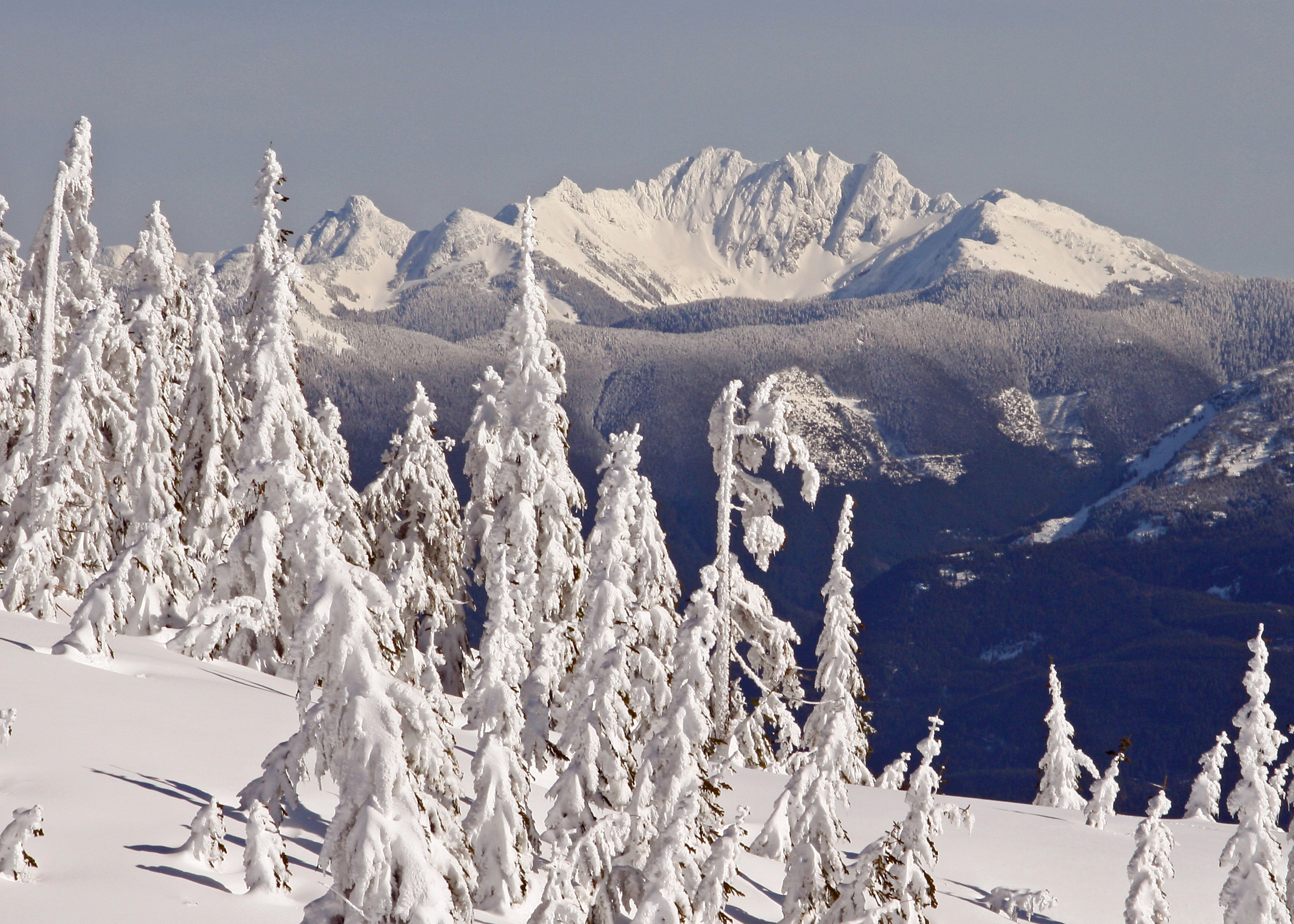
Hemlock is a small gem of a ski area in the Fraser Valley of British Columbia. On a big day, Hemlock may host 1,150 skiers: the existing resort has 4 ski lifts servicing 35 trails on 145 hectares. It is renowned for its deep snow, great ski terrain and amazing vistas. The Sts’ailes First Nation has long considered the area magical, and the locals are well aware of its incredible potential for expansion.
In 2008, our firm, Brent Harley and Associates Inc. (BHA) was retained to create a Master Plan for Hemlock. We are a Whistler-based firm that focuses on the design of mountain resorts throughout the world. Our client, The Berezan Group, instructed us to fully explore the potential of expanding this fledging ski area into a major, all-season world-class destination resort. The Sts’ailes First Nation has long considered the area magical.
TAKING THE MEASURE OF THE MOUNTAIN
We acquired digital mapping of the surrounding Crown lands and initiated the project by completing an in-depth, GIS-based analysis. By layering the site’s characteristics (slope, elevation, aspect, fall-line, shape) with the environmental attributes (climate, vegetation, water, wildlife habitat, corridors), it quickly became clear to us that Hemlock’s potential was significant. The area has a wide variety of skiable and recreational terrain with a reliable snowpack, yearround backcountry opportunities, striking vistas and a beautiful mountainous setting dropping down 1430 metres to Harrison Lake.
Our analysis continued with an inventory of the logging, mining and backcountry tenures. Finally, and perhaps most importantly, we considered the historic and current land use interests of the Sts’ailes Band, encouraging the Berezan Group and the Band to initiate a “chief-to-chief” dialogue.
We created a wide variety of concepts, all envisioning a “unique cutting edge, four season mountain resort” with a sweeping appeal. The concepts were vetted through an iterative process that culminated in the Hemlock Master Plan. The mountain plan proposes a vast array of facilities for Hemlock, yet all are designed and located in harmony with the natural attributes of the terrain so as to minimize the resort’s footprint on the land. Hemlock would transform into an easily accessible refuge from the City.

GOING UP AND COMING DOWN
The Master Planning process focused first on Hemlock’s primary attraction, the ski terrain. New skiing and snowboarding opportunities, staged from a series of villages, would promise diverse ski opportunities for all levels of skiers. We designed ski trails that optimize the skiing experience, taking into account slope gradients, orientation, reliable snowpack, skier skill classes (beginner, intermediate, expert), linkages and travel times. We considered connections to the base area villages and residential areas, to enhance the ski-to/ski-from opportunities. Day skiers and destination guests could choose to spend each day in a single area of the mountain or range further afield, exploring, travelling over snow from one end of Hemlock to the other.
From that starting point, we sited appropriately-sized ski lifts to complement trail location and design, balancing downhill capacities of the trails with uphill capacities of the lifts. This enabled us to calculate the Comfortable Carrying Capacity (CCC) of the resort in terms of total number of the skiers and snowboarders per day. At buildout, Hemlock will have 23 ski lifts servicing 283 formal trails, plus glades, for a total of 1,255 hectares of developed ski terrain. The alpine skiing facilities will have a CCC of 13,500 skiers/boarders per day.
GOING NORDIC – AND BEYOND
Like every world class winter resort, however, Hemlock needed to look beyond the Alpine equation to add Nordic skiing, backcountry touring, snow play, ice skating, snowshoeing, tubing, snowmobiling, winter ziplining and an extensive multi-use network of trails. Summer facilities, too, were incorporated to cater to the expectations of guests, secondhome owners and residents: a network of trails (a paved “valley trail” system, gravel surfaced trails, single track trails), liftserviced facilities and activities (mountain biking, sightseeing, ziplines, an aerial adventure park, hiking, interpretive tours, horseback riding), waterfront facilities on Harrison Lake (beaches, boating, a marina, swimming, fishing) and two eighteen-hole golf courses.
With these additional outdoor attractions, plus indoor facilities and passive visitors, Hemlock could welcome another 3,200 guests per day. The Balanced Resort Capacity (BRC) increased to a potential 16,700 guests per day.
MEANWHILE BACK AT THE LODGE
Analyzing how the terrain could provide for the staging requirements of some 16,000 guests was the next challenge. We considered such specifics as resort core development, creating a sense of arrival, tallying visitor walking distance, considering changes in grade, viewsheds, solar access, size and scale of resort facilities, 3D massing, architectural programming, skier/pedestrian/ vehicular relationships, operations, back-ofhouse facilities, overnight accommodation, residential development and environmental sensitivities.
The types of built space included guest services of all kinds: restaurants, day lodges, vehicle access, parking, rental and repair shops, ski school, patrol and first aid, day care, lockers, resort administration and employee facilities. By buildout, Hemlock will have increased built space more than 17-fold, from the existing 1505 square metres to 25,966 square metres.
To tally the overnight accommodation required, we analyzed not only capacity, but the number of day-use visitors versus destination guests and the critically important need for employee and resident housing. We determined that at buildout, the resort should have some 20,000 beds: 40 per cent public (hotels, condotels, pensions, nightly rentals), 45 per cent private (single family chalets, condos, townhouses) and 15 per cent resident housing.

THE MOUNTAIN SCENARIO
Hemlock in the future will include five distinct villages, each with special attributes, and a series of resort residential subdivisions, all designed to service the adjacent mountain facilities, all linked by trails and lifts. Economic conditions will determine the pace of implementation, but development is divided into five sequential phases, with each phase creating a finished, well-balanced resort in its own right. Hemlock has a Joint Venture Agreement in place with the Sts’ailes Band, and has approval from the BC Environmental Assessment Office. (A Master Development Agreement with the Province is under negotiation.) The developer has begun to implement the first phase, and BHA will continue to refine the design, to establish Hemlock as a unique, major destination mountain resort.
 © 2019 BHA
“My reviewing professor liked the design but cautioned that he was unsure if it was really landscape architecture.” – Brent Harley
The following article by Brent Harley was featured as the Last Word in the CSLA publication Landscapes – Vol. 16, No. 1 which can be read here.
Mountain Resort Planning has always been the focus of my career as a landscape architect. I have worked all over the world on incredibly interesting all-season ski resort projects, from major destination resorts designed to host the Olympics to small ski areas that are key elements of local community recreation programs.
My career really began back in 1975 when I presented my design for the development of a ski area as one of my final projects for my BLA at the University of Guelph. My reviewing professor liked the design but cautioned that he was unsure if it was really landscape architecture.
In 1977, after a winter of ski bumming in Jasper, Alberta, I was hired by a landscape architectural firm to help with the master plan of the Capital City Park System along the North Saskatchewan River in Edmonton. As luck would have it, in the second week of my employ, my boss came in and said, “We have to include a ski area in the Park. Who here knows anything about ski area design?”
I immediately let him know that I knew everything about ski area design. The project was mine. Over the course of the next year I began to realize how little I actually knew. Learning on the job, I finished the design and then spent the summer supervising construction of the facility. This experience landed me a job in Whistler, BC to help with the initial designs for Blackcomb. This in turn led to other ski area projects.
The Silence Was Deafening
Believing that my career in ski resort design would benefit by my becoming a registered landscape architect, I diligently wrote and passed all of the BCSLA exams. (This was pre-CLARB.) The final test was an interview with the BCSLA’s Board of Directors. During my presentation of the ski resort master plans that I had completed, one of the Board members stated that, while interesting, he wondered whether this was really landscape architecture and asked to see examples of planting plans that I had completed. When I informed him that I didn’t have planting plans to present, the silence was deafening. My application to join the BCSLA was denied. Disagreeing with this small-minded attitude had a big impact on my career. I believed (and still believe) that the development of large scale “design on the land” falls well within the definition of landscape architecture as coined by Olmsted and others. I persevered and was invited to join the BCSLA and the CSLA the next year (following the presentation of a planting plan for my backyard). Since that time, I have proudly called myself a landscape architect while remaining focused on mountain resort design and planning. My firm has completed projects throughout Canada and the United States; Japan, Korea and China; Australia and New Zealand; Bulgaria and Armenia. Over the years, we have expanded our offerings to include all-season facilities, resort-oriented village design and mountain residential development…all very much within the realm of landscape architecture. As a landscape architect, I believe that I bring more to the table than the planners, architects and/or engineers that so often undertake the specialized work of ski resort design. In projects such as this, landscape architects combine their diverse range of abilities to explore the attributes of the land, align the opportunities and challenges with the desired intent, craft creative detailed solutions and graphically communicate the process and end result. As a profession, we have the skill set to offer a holistic design approach. This should be promoted and celebrated more often
 © 2019 BHA
“I have not seen anything more visionary, more forward-looking, more out-of-the-box thinking in all of the years I have sat through meetings here”
The following article by Seth Truscott has been copied from the Snoqualmie Valley Record. A link to the original article can be found here.
BHA visited Snoqualmie in August 2014 to present the Draft Master Plan work to the community, the following was written about the meeting.
A riverside boardwalk in downtown Snoqualmie has been a dream for nearly a decade.
That dream took a step closer to reality Monday, August 24th, when Snoqualmie City Council set aside more than half a million dollars as match funding for a potential grant. The council voted unanimously to reserve $713,000 in order to seek a Washington State Department of Ecology Floodplain by Design grant for the city’s Snoqualmie Riverfront Project.
That project calls for new river trails on both sides of the Snoqualmie River in downtown Snoqualmie River in downtown Snoqualmie, centred on a riverside boardwalk between King Street and River Street. The city would have to buy nine properties to build the system.
The city already has two parks, Sandy Cove and Riverfront, accessing the river. But trees and fences block the view at Riverfront, and Sandy Cove’s shore is set back from downtown.
“There really are no developed riverfront views,” said Hollenbeck. “Riverfront Park is very ironically named.”
The downtown river walk was first mooted in 2008 by urban planning consultant Tom Beckwith, who was hired to draw up a downtown master plan.
“We’ve been talking about this walk fro years” said councilwoman Kathi Prewitt. “It’s nice to see it start to come together.”
Last Monday, Finance Officer Rob Orton laid out how the city will pay for it. The city has about $118,000 in cash, interest from the city’s fallow pedestrian bridge fund. Snoqualmie would also use $140,000 slated for a gateway arch project, and $45,000 previously set aside to pave the vacant King Street lot. For the rest, the city will dedicate future real estate excise taxes from the sale of property. The city gets half of 1 percent of the sale of all eligible property in city limits, with most sales happening on Snoqualmie Ridge. Orton predicts about $360,000 in excise revenue between now and 2015.
“We’ve had a big increase in the velocity of sales on the Ridge, and sale price,” he told the council.
Community Input
Carolyn Simpson, chair of the city’s Economic Development Commission, says the river walk will change the city in good ways. “I have not seen anything more visionary, more forward-looking, more out-of-the-box thinking in all of the years I have sat through meetings here,” she said.
The past year, Simpson said, her family visited Winthorp, Wash., Bend and Grant’s Pass, Ore., and Napa, Calif.
“Each of those have something similar in their river areas,” she said, “and people were out there, a variety of ages, a variety of activities, participating in businesses, sitting in restaurants, right on the river.”
The commission unanimously supports the concept, she said, adding that it could revitalize businesses throughout the city.
“It will attract more employers who want their employees to appreciate, live, work and play in our community,” said Simpson. “We believe it celebrates the natural history and beauty of our community.”
Wendy Thomas, owner of Carmichael’s True Value Hardware, added her support. She told the council she had been waiting for downtown Snoqualmie to become a destination for tourism.
“This particular project makes me more encouraged and optimistic than I’ve been in some time,” she said. “Sometimes you have to take a risk. And I think in this case, it’s a good one.”
Some Questions
Councilman Charles Peterson was the voice of caution, asking about parking and maintenance costs.
“To make this viable, you have to have a place to park,” he said. “There’s certainly going to be maintenance costs on this trail,” Peterson added. “If we build something and people are going to use it, we better make sure we have a safe product.”
City Administrator Bob Larson replied that the current downtown infrastructure project adds spaces.
“With or without the King Street lot, there is going to be a net gain in parking stalls downtown at the conclusion of Phase 2A.”
Maintenance estimates are part of the scope of design work that is coming, said Hollenbeck.
“We can quickly draw that together,” said Larson. “Knowing we’ve already got 27 miles of rough trail, and miles and miles of side walk, we can get a good estimate. It’s not going to be overwhelming.”
The Ecology grant is for projects that reduce flood hazards and help floodplain ecosystems, while improving open space and recreation. The total project cost – property acquisitions, restoration work, and design and construction of the riverwalk trail, including the downtown boardwalk segment – is $5.1 million.
The Floodplains by Design grant asks for $3.6 million. Of the remaining non-state matching funds, $750,000 would come from the King County Flood Control District, $38,000 from other grants.
If awarded, the project would begin in 2015.
 © 2019 BHA
“When we do a master plan,” (Brent) says, “it’s more than just the ski lifts and the trails. It’s the full meal deal. It’s looking at all aspects of the operation.”
The following article by Nicole Veerman has been copied from Vueweekly.com. A link to the original article can be found here.

Brent Harley – Product Testing
Designing a master plan for a ski hill isn’t just about putting a lift here and a chalet there. It’s about envisioning the hill’s entire operation–everything from the number of parking stalls to the size of the water and sewer lines.
It’s a long process. The plan alone can take a handful of years to complete, depending on the size of the project and the number of government approvals required.
Brent Harley, owner and president of Brent Harley and Associates, a mountain resort design firm in Whistler, BC, has been designing ski hills for 34 years. His first was Edmonton’s Sunridge in the ’70s.
As a result of that project, Harley was hired to help design Blackcomb in 1978, so he moved to Whistler, where he remains to this day.
“When we do a master plan,” he says, “it’s more than just the ski lifts and the trails. It’s the full meal deal. It’s looking at all aspects of the operation.”
The first step in that process is determining the comfortable carrying capacity for the proposed ski area. “By that,” he explains, “I mean how many people can this ski hill hold and provide a really great skiing experience for.”
To determine that number, designers analyze the available ski terrain, considering the three ski levels: beginner, intermediate and expert.
That’s done by looking at digital maps of the area, which show the slopes’ skiability.
When it’s determined how many skiers the terrain can sustain, the designers consider the uphill carrying capacity and come up with a comfortable balance between the two.
“Then that gives you a number that you have to translate into the base area,” Harley explains.
For example, if it’s determined that 1000 skiers can comfortably ski on the terrain, then the designers translate that number into the number of required parking stalls and the amount of room necessary in the day lodge. That number will also determine what type of services are needed—whether there’s day care available, or whether there’s one bar or more, or one restaurant or more.
“All of those things need to be understood to bring this whole ski hill into balance,” Harley says. “And then, once you’ve got that figured out, you start asking questions directly associated with that.”
Questions like, are hotels needed; if there are hotels, then how many additional restaurants are needed; and should there be other activities to entertain guests after they finish skiing?
Once all of the questions are answered and the resort’s winter concept is figured out, then the designers start to consider summer activities that will make the hill sustainable.
“All resorts now, all ski areas, have come to a position where they have to be four-season operations to make a go of it. So it’s more than just skiing now: you have to understand the year-round experience.”
That could be anything from a golf course to mountain biking, sightseeing, aerial adventure parks or a mixture of the bunch.
“All of those things have a capacity, as well, so then you bring that back into balance,” Harley explains.
Then, with the concept in place for both the winter and the summer months, designers consider how and when the runs and lifts should be developed.
“You want to be able to take baby steps at first,” Harley says. “Put a couple of lifts in, put a day lodge in. Ultimately, though, it’s a dozen lifts and a village, but each one of those steps leads to the next one. And, again, it needs to be well balanced. It has to have beginner skiing in phase one, as it does intermediate and expert skiing in phase one. You can’t have it all beginner, you can’t have it all intermediate. You have to provide for the whole market place right from the beginning.”
To do that, designers consider that 20 percent of skiers on the hill are beginners, 20 percent are experts and the remaining 60 percent are intermediate. So, when designing the hill and laying out the phases of development, those ratios are considered.
“The goal is to create that balance on a phase-by-phase basis,” Harley says. “And, each one of those phases has to be able to stand on its own, especially in the big projects, otherwise you end up with signs saying, ‘Wait until you see us in phase five’ and big holes and all sorts of problems.
“So, each one of those phases in the master plan are always designed as a finished project because you might be living in phase three forever.”
Whistler is an example of how development can be phased in. In the late ’70s, only one side of the mountain was developed and there was no village. More than three decades later, there is a massive village, the opposite side of the mountain has been developed, and so has Blackcomb.
“It’s been an incremental process. But, then again, Whistler is kind of one of those perfect-storm projects. Everything has worked out really well for it over the years.”
Not every project is like that, says Harley. Sometimes during the planning stages, even before a shovel has left the back of the truck, the developer and the designers realize there’s just no way to make the project work.
“We always get to decision points in our project where, in a worst-case scenario, you get to a go or no-go decision point and it might be that as you’re going through this exercise there might be enough fatal flaws with the site and with the circumstances that it’s just better to not go there.
“That’s part of the risk as the developer.”
Other complications that can halt a project are government approvals. For instance, if a developer wants to develop on Crown land, then they first have to submit an expression of interest for that land, putting into motion a review process and environmental assessment.
There are also consultations that need to happen with area First Nations and the municipality.
“In the case of British Columbia, it goes to a master plan that gets filed to the government and then they go into a master development agreement and then part of that goes to whatever municipality you’re working in, then you’re into zoning bylaws and community plans, and all of that stuff has to be in place before you put your first shovel in the ground,” Harley says.
Nowadays, he adds, the process take much longer than it did 20 or 25 years ago because people have a greater concern about how a development will affect the environment.
So, brand new projects—referred to as “green fields”—are under greater scrutiny.
An example of that would be Jumbo Glacier Resort, about 55 km outside of Invermere, BC. Jumbo was proposed decades ago, and was thought to be dead, until last March when the provincial government approved it.
The $1 billion development that will become Canada’s first year-round glacier-based ski resort was first proposed in the early ’90s.
“There are lots of project like Jumbo that have taken just as long. There’s one in Squamish, it’s called Garibaldi. It’s been around for at least 30 years,” Harley says.
“Ski hills definitely take years to develop.”
 © 2019 BHA
“We will be the only ski hill in North America that has light rail transit. That’s a pretty powerful statement when you think about it.” – Ken Saunders
The following article by David Howell has been copied from the Edmonton Journal. A link to the original article can be found here.

Edmonton Ski Club president Ken Saunders at the club Photograph by: Greg Southam , Edmonton Journal
The venerable Edmonton Ski Club just off Connors Road has big ambitions fuelled by a new master plan and the coming development of the Valley Line LRT.
“The LRT is now in a position where it will enhance our new development,” says Ken Saunders, the club’s president.
“We will be the only ski hill in North America that has light rail transit. That’s a pretty powerful statement when you think about it.”
Saunders says the LRT, scheduled to open by late 2020, will improve the club’s presence and accessibility. He envisions commuters stopping in for a quick ski or workout on their way downtown.
The club, founded in 1911 on a hill with a maximum vertical drop of only 61 metres, has been a learning facility for generations of Edmonton kids. Olympic medallists Jennifer Heil and Mike Riddle both skied there as youngsters.
The club has had its financial challenges. Much of its infrastructure, from the lodge to the T-bar lift, needs updating, Saunders says.
For the past couple of years, management has been working on a master plan that would guide future development at a capital cost of $10 — $15 million. The Cloverdale Community League has been consulted, as has the Edmonton Folk Music Festival, which uses the grounds each August.
Concepts have been drawn up by Brent Harley and Associates, Inc., a Whistler, B.C. firm that designs ski hills, golf courses and mountain resorts.
The plans would see a new day lodge and parking areas built within a short walk of the Valley Line station planned for the Muttart Conservatory.
The winter concept features a chair lift and for newbies, a carpet lift. A skating pond would connect to a skating loop extending to the Cloverdale community hall. There would be trails for beginning and advanced cross-country skiers and a tube park on Gallagher Hill, with its own lift.
The summer concept includes a bike skills park, a climbing structure echoing the long-gone ski jump over Connors Road, and a children’s play area.
If the plan wins approval from the city, which owns the land, a fundraising campaign would follow. Money would be sought from the city and the province, and from other sources, Saunders says.
David Dorward, MLA for Edmonton-Gold Bar, supports the ski club’s ambitions.
Dorward can relate to the dream. He skied at the hill as a boy and before entering politics, he founded the GO Community Centre, a $38-million multi-use gymnasium that is part of the Saville Sports Centre.
The ski club could become a real hub of activity year-round, Dorward said. “As more and more people embrace the winter, it could be a place where people go to cross-country ski — it’s two blocks from there into the river valley. It doesn’t just have to be the downhill component.
“I think there’s an opportunity for it to be a beehive of activity in terms of summer sport because of the connectivity to the river valley trail system. What better place to go than a location like that — right near the Muttart, right on the LRT line — for biking and hiking, whatever.”
Sitting in the lodge on a quiet afternoon, Saunders gets wistful about the future of the facility that is a favourite of his sons Paul, 14, and Nick, 12.
“Spending some time standing at the top of these runs, there’s something about this place that captures the imagination,” Saunders says. “You stand up on that hill, you look across at the city, you see the Muttart, and you think, ‘There’s something here’.”